Hiking Oregon: The Top 5 Trails
There aren’t many comparably sized regions in the world that pack in such diverse wild scenery as Oregon. Temperate rainforest to salty desert, ocean breakers to glacier-crowned volcanoes, oak parklands to juniper scrub, beach rivers to kaleidoscopic badlands—it’s all here, spread across an outdoors-loving state that’s over 50 percent in the public domain.
With such landscape variety and so much backcountry to choose from, it’s not easy to narrow down a list of the Beaver State’s best hiking trails. Be that as it may, here’s an Earth Gear roundup of five excellent choices, ranging from no-sweat strolls to epic odysseys.
Captain Cook Trail
Oregon’s western margin forms one of the world’s great coastlines: rainforest Coast Range ridges spilling to raw headlands, seastacks, sand spits, and dunes against the brooding North Pacific. With essentially the entire seashore in the public domain, you’ve got any number of stellar spots for outdoor recreation. Any thorough exploration of the Oregon coast, though, has to include Cape Perpetua, a basalt headland anchoring an extraordinary swath of the Siuslaw National Forest south of the idyllic hamlet of Yachats.
The Cape Perpetua National Scenic Area offers a wealth of hiking opportunities, including backcountry forays through the spruce cathedrals of the Coast Range. But for an unbeatable introduction to the primal power of the Oregon coast, make a loop out of three short oceanfront routes: the Captain Cook Trail, the Cape Cove Trail, and the Trail of the Restless Waters. Less than two miles total and suitable for most ages and conditions, this hike gives you front-row seats to a marvelous confrontation of surging brine and rugged basalt seacoast.
This bluff-to-breakers path leads through wind-beaten Sitka spruces, salal tangles, and ancient American Indian shell middens to the rocky shore, where the Pacific slams and splashes against tide pool benches. If you’re hiking around Cook’s Chasm at high tide, watch as waves funneled through the Spouting Horn spray great plumes. The aptly named Devil’s Churn, meanwhile, reachable via the Trail of Restless Waters, is an intimidating boil. Above you looms the bold crest of Cape Perpetua itself (the summit of which, reachable by the nearby St. Perpetua Trail or a paved road, is the highest point you can drive to along the immediate Oregon coast and a great place to spot gray whales during their biannual migration flybys).
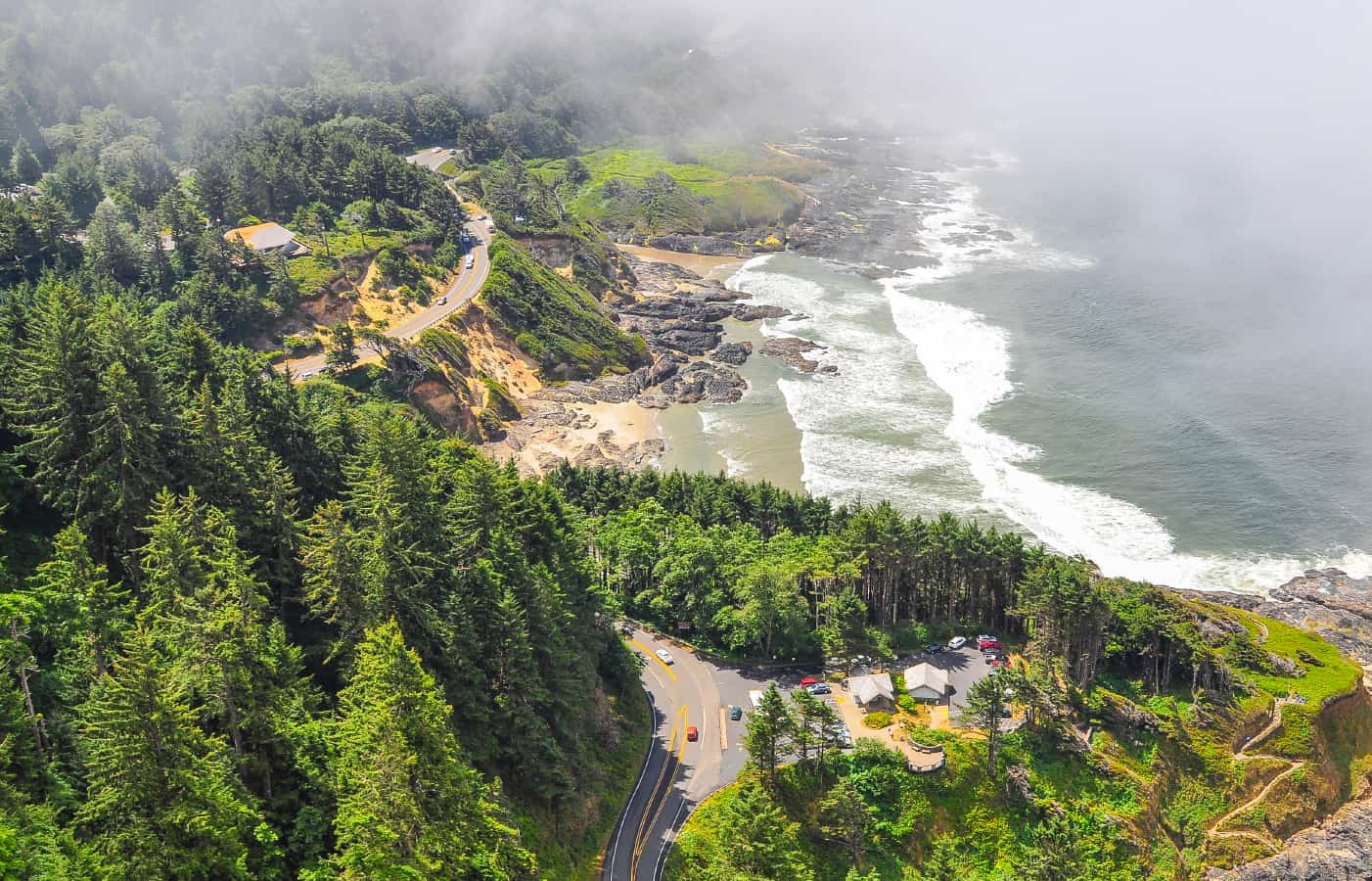
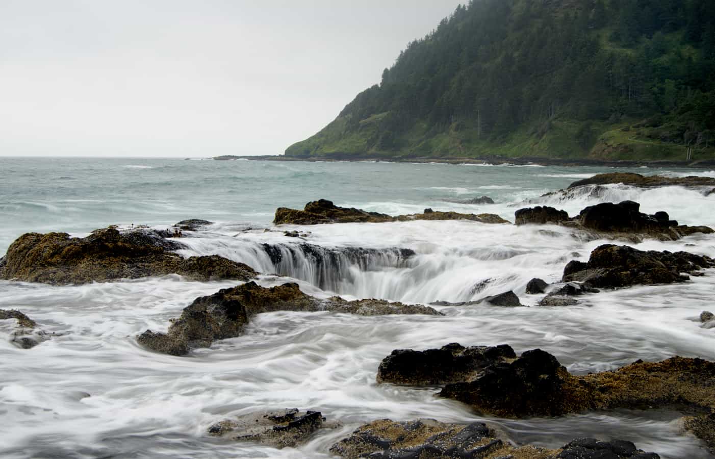
A word of real caution: While this trail is not challenging, the shoreline it leads to is raw, rough, and unfenced. The mantra along the Oregon coast is, “Never turn your back on the ocean!” and for good reason: So-called “sneaker waves” can unexpectedly sweep over oceanfront rocks, and a look into Cook’s Chasm or the Devil’s Churn suggests how horrifying—and potentially lethal—falling into the Pacific here would be. Watch the swells (and your footing), monitor the tide, and stick to the bluff-top during storms. And if you’re on a family trip, make sure the kids—who are going to love this outing—stay close! A word of real caution: While this trail is not challenging, the shoreline it leads to is raw, rough, and unfenced. The mantra along the Oregon coast is, “Never turn your back on the ocean!” and for good reason: So-called “sneaker waves” can unexpectedly sweep over oceanfront rocks, and a look into Cook’s Chasm or the Devil’s Churn suggests how horrifying—and potentially lethal—falling into the Pacific here would be. Watch the swells (and your footing), monitor the tide, and stick to the bluff-top during storms. And if you’re on a family trip, make sure the kids—who are going to love this outing—stay close! The Cape Perpetua Visitor Center has a breathtaking view of the ocean from inside, and from the wheel-chair accessible deck. It’s open seven days a week and the staff is available to answer questions and help you plan your trip. (541.547.3289)
Watchman Peak Trail
The Cascade Range is most famous for its chain of volcanic snow peaks, which in Oregon include Mount Hood, Mount Jefferson, the Three Sisters, and Mount McLoughlin. Kin to these handsome cones is Mount Mazama, a gargantuan stratovolcano that once may have towered over them all: In its heyday, it might have been 12,000 feet tall. About 7,700 years ago, however, Mazama erupted to catastrophic effect, and its summit collapsed into an immense caldera. This blasted crown flooded with snowmelt to produce one of America’s great natural landmarks, Crater Lake—among the purest, deepest, and most gorgeous lakes on Earth.
And one of the best trails for viewing this dreamlike scene—the centerpiece of Crater Lake National Park—is that up Watchman Peak, one of the high crags forming Mount Mazama’s blasted rim. This is no mountaineering feat: It’s only an eighth of a mile one-way to the venerable Forest Service fire-lookout tower at the Watchman summit, although the elevation—topping out at 8,056 feet—and the switchbacks mean you may be huffing and puffing. Considering the outstanding view from the tower, the trail delivers one of the biggest bangs for your buck of any in Oregon.
Below you, Crater Lake shimmers its unreal hue, nestled by sheer cliffs; Wizard Island, a timbered cinder cone built up after the defining eruption, swells out of the depths. Some of Mazama’s subsidiary vents—Garfield Peak, Hilman Peak, Mount Scott (highest point in the park)—rise in the near distance, while High Cascade summits march north- and southward: Mount Bailey, Mount Thielsen, Mount McLoughlin, and—if conditions are clear enough—the 14,162-foot mass of Mount Shasta. It’s not the kind of vista you forget and a great adventure for those interested in hiking Oregon.
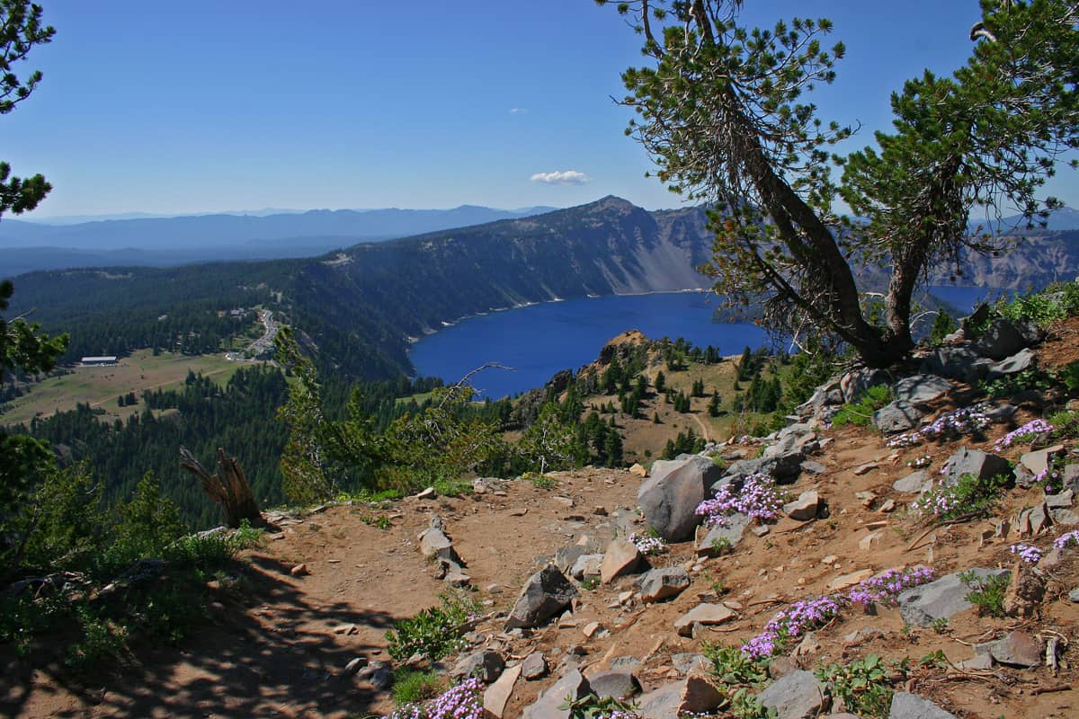
Crater Lake Garfield Peak Trail View of Rim
via: Wikimedia Commons auth: Markgorzynski
Gazing upon Mount Hood by Matt Payne on 500px
Smith Rock Loop
Smith Rock, situated in the high lava plains of the Cascade rainshadow near Redmond, presents another of the Beaver State’s beloved landscapes: a fortress of spires, hoodoos, and castellated ridges forged by time and water from rhyolitic ash spat from ancestral Cascade volcanoes. Smith Rock State Park is probably best-known as a rock-climber’s mecca, but the hiking here is topnotch as well.
You can loop through the park’s compact but rugged scenery by linking together several of the main trails into a logical, roughly four-mile circuit: from the parking area across the Crooked River via the Chute; up and over Misery Ridge via the Misery Ridge Trail; then down again to the riverside via the Mesa Verde Trail and back to the footbridge via the River Trail. Give yourself a half-day or more to fully appreciate the setting.
The immediate scenery’s breathtaking, from the walls of Smith Rock proper and the nearby fins of Gray Butte to the club-like pillar of Monkey Face. Stately ponderosa pines trace the Crooked River’s spectacularly crooked course, while gnarled junipers cling to the tough scarps. From Misery Ridge, you can take in a glorious prospect of Cascade ramparts: the postcard lineup of Broken Top and the Three Sisters, the perfect cone of Black Butte, the tooth of Mount Washington, the northerly giants of Jefferson and Hood. Also visible is the subtle but enormous swell of Newberry Volcano, an epic shield volcano east of the main Cascade line.
Sun protection’s a must for this loop, as is adequate water. Spring and autumn are great for doing the Smith Rock loop, both from a weather and crowd perspective; wintertime hikes may be mostly snow-free depending on conditions, but watch for slippery ice glaze.
Timberline Trail (Mount Hood)
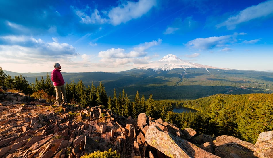
Several Cascade snowpeaks have epic trails circumambulating their fearsome bulk: the Loowit Trail around Mount St. Helens, for instance, and the Wonderland Trail around Mount Rainier. Mount Hood’s no exception: This loftiest of Oregon peaks has the Timberline, easily one of the most scenic of the state’s trails and also a hearty multiday challenge. As the name suggests, this 40-miler—a goodly portion of which overlaps with the Pacific Crest National Scenic Trail—rounds the 11,239-foot stratovolcano mostly at the margin between subalpine forest and the mountain-hemlock/subalpine-fir/whitebark-pine tree islands, verdant meadows, pumice barrens, and outcrops of the high country. The glacier-encircled horn of Mount Hood glares down throughout the route—except, that is, when its frequent cloud cap descends.
A big plus of the Timberline Trail is the presence of Timberline Lodge, the historic Forest Service-managed hotel perched at about 6,000 feet up Mount Hood’s southern flanks. Use the Lodge as your starting and endpoint, and you’ve got beers, burgers, and even a swimming pool to reward you at the end of your adventure.
That said, much of the Timberline Trail treks through high, rugged wilderness on a volcano infamous for fitful weather. Among the chief hazards are several crossings of big glacial rivers—the White, the Eliot Branch, the Muddy Fork, the Sandy, and the Zigzag—as well as smaller streams. These drainages can be dangerously swollen and strong in spring and early summer, and occasionally violent debris flows sweep down them; their channels can change dramatically from season to season. Hikers have drowned on this trail. It’s best to check with the Mount Hood National Forest to find out about up-to-date river and trail conditions, and to try to time your fords for the first half of the day (there’s more glacial and snowfield runoff during afternoon high temperatures).
Oregon Desert Trail
Right off the bat, let’s acknowledge that the Oregon Desert Trail is still in the process of becoming. The vision of the Oregon Natural Desert Association, this 800-mile-long route through some of the Beaver State’s emptiest, most sublime wildlands is still being linked together and formalized. And substantial stretches of it are cross-country in nature, not trail-hiking. But the route promises one of the great backpacking adventures in the West, linking as it does huge and sparsely populated expanses of steppeland and semi-desert outback. It’s an excellent complement to the far better-known Pacific Crest Trail hugging the Cascade crest.
The Oregon Desert Trail links the Badlands Wilderness near Bend with Lake Owyhee State Park close to the Idaho Line, forming a meandering arc through southeastern Oregon’s Great Basin sector in the process. Among the absolute highlights are Hart Mountain National Antelope Refuge, a yawning landscape of rimrock and basins supporting some of America’s most significant pronghorn herds; Steens Mountain, a huge fault-block ridge that, at nearly 10,000 feet in elevation, is one of Oregon’s grandest peaks; and the Owyhee Canyonlands, which encompass some of the most remote territory in the U.S. and summon comparisons with the slickrock scenery of the Colorado Plateau.
Intrepid hikers are already scouting out the Oregon Desert Trail trace, but you should be fully prepared for wilderness self-sufficiency—and the special climatic harshness of the Oregon outback—if you decide to join their adventurous ranks.
A Few Words on Oregon Hiking and Safety
Much of Oregon—not just the semi-arid southeast—is remote, and you don’t need to be backpacking in roadless wilderness to get into a fix: The rough backroads accessing some trailheads may be far from civilization and little-traveled. Pack the wilderness essentials (even on short day hikes) and always relay your route itinerary with someone before you hit the trail.
Oregon no longer has grizzlies, but black bears and pumas are common and found statewide (except for semi-desert steppes). Neither carnivore is likely to tangle with you, but you should make noise when hiking through dense vegetation or along noisy streams to minimize a chance encounter with a bear. You’re also unlikely to see a Pacific rattlesnake, but—especially in southwestern and eastern Oregon—you should watch your hands and feet when scrambling through rocky brush. Poison-oak’s an issue at lower elevations and in drier settings west of the Cascade crest.
Be prepared for sudden changes in the weather—especially in the fickle mountains. Particularly in the Cascades, maritime storms (mostly a fall-through-spring phenomenon) can sock in the higher country for days—and dump epic amounts of heavy, wet snow.
The five trails presented above are certainly world-class, but treat them as ice-breakers for deeper explorations: From the Siskiyous to the Wallowas, there’s an embarrassment of other wilderness jewels our list doesn’t even sideswipe. Get out there and explore the Beaver State!
Recent Camping & Hiking Posts
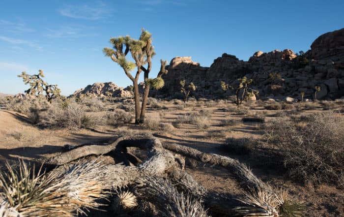
Experiencing Joshua Tree National Park
Experiencing Joshua Tree National Park A few years ago while on vacation in Palm Desert, we made the decision to go for a drive and explore the surrounding area outside [...]
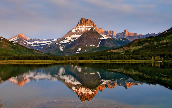
Camping Glacier National Park
Camping Glacier National Park Information Camping Glacier National Park; Glacier National Park, together with the adjacent (and smaller) Waterton Lakes National Park in Alberta, encompasses some of the most gorgeous mountain scenery in North America. [...]
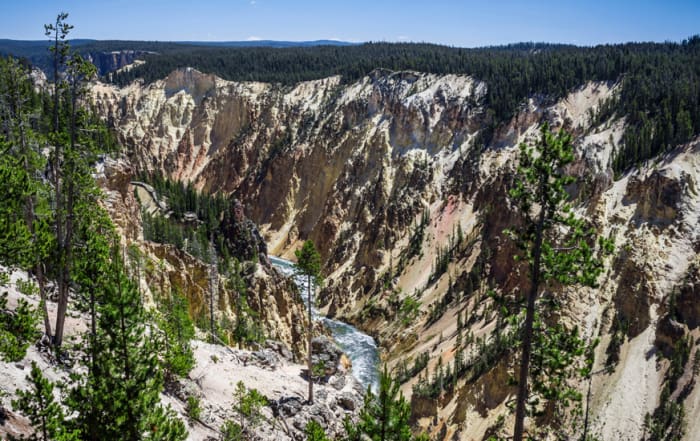
Camping Yellowstone
Camping Yellowstone National Park Camping Yellowstone National Park; Yellowstone may well be the most famous national park in the world; in any case, it can proudly lay claim on being the oldest, established back [...]
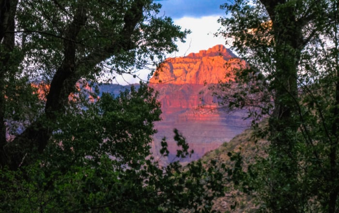
Grand Canyon Camping
Experience the Thrill of Grand Canyon Camping Grand Canyon Camping; The Grand Canyon of the Colorado River, the crowning landform of the breathtakingly scenic Colorado Plateau, ranks among the largest and most awe-inspiring gorges [...]
Backcountry Technology
Outdoor Backcountry Technology: The Best in Outdoor Tech Outdoor Backcountry Technology: Some say they seek adventure in the outdoors to escape the trappings of technology, society, and the everyday. We get it. But [...]
Best Backpacking Backpacks
The Best Backpacking Backpacks: Earth Gear's Top 3 If you’re like us, you probably spend an incredible amount of time obsessing over the gear you need when you are planning your next adventure. [...]
Best Camping Tents
Best Camping Tents: Earth Gear's Top 3 Best Camping Tents: The right tent is your home away from home when camping. Choosing the right tent can [...]
Choosing the Right Camera
Choosing The Right Camera to Capture Your Adventure If you believe in the old hiking and backpacking adage; take nothing but pictures, leave nothing but footprints, kill nothing but time, then you are a [...]
Insulated Jackets
Earth Gear Choices for Insulated Jackets You want to be warm when the temps start to drop? I mean, do you really want to be warm? Do you want to be warm, but are [...]
Sentinel Pass Moraine Lake
A Day Hike You’ll Never Forget: Lake Louise Alberta Sentinel Pass Moraine Lake: If you find yourself in the Lake Louise area of Alberta Canada during the summer and early fall [...]
All Recent Posts
Fall Hiking Gear
The Best in 2020 Fall Hiking Gear Looking for information on fall hiking gear? No offense to the other seasons, but Autumn is the best time to hike throughout much of the Northern [...]
Outdoor Technology
Outdoor Technology: Hiking Backpacking and Camping You may not be a fan of outdoor technology. It may be due to a lack of understanding, maybe you think that it’s too complicated, or you [...]
Handcrafted Log Homes
Handcrafted Log Homes Handcrafted log homes in North America date back to 1638. That is about the time that historians believe that log home construction began in the United States. Historically, log homes [...]
Best Cocktail Recipes
Best Cocktail Recipes Have you ever wondered what the best cocktails are for entertaining your friends? Earth Gear has - and we thought we would bring the best cocktail recipes to you. But first [...]
Sayulita Vacation
Crimson Skies of Sayulita If you are looking for an off-the-beaten-path travel destination, a great place to surf, reflect, rejuvenate, and soak up the sun then look no further than a Sayulita Vacation. This [...]
Big Island Hawaii Things To Do
Big Island Hawaii Things To Do, A Journey of Beauty and Contrast The big island Hawaii has a history datable to 1,500 years ago when a small fleet of canoes landed on the island's [...]
Climbing Mount Rainier
Climbing Mount Rainier Climbing Mount Rainier: At 14,411 feet, Mount Rainier—or Tahoma, as regional American Indian tribes called it—falls a little short of the loftiest Sierra Nevada and Southern Rocky Mountain peaks. You can [...]
Iceland Adventure Travel
Iceland — The land of Fire and Ice Iceland Adventure Travel; Iceland is home to just under 325,000 people who live in a habitable area of 103,000 square kilometers. The largest city is the [...]









Leave A Comment